Bulletin 18 - November 1982: Qarn bint Saud
Qarn bint Saud
by Rob WesternQarn bint Saud is an isolated anticline of gray limestone streaked with veins of quartz situated some 12km to the north northwest of Hili. It may be reached from either Mas'udi or Hili (both suburbs of Al Ain) via a good surfaced road sign-posted to the Bidi bint Saud water project. After passing through a dense stand of Prosopis spicigera trees, the road undulates in a straight line over deep orange dunes and offers some spectacular vistas of the Hajar mountains to the east and Jebel Hafit to the south.
The outcrop lies on a north northwest -- south southeast axis, and is just over half a kilometer long, about 200m wide and 40m high at the center. The east flank is steeper than the west and contains several caves with fire-blackened roofs which would definitely repay excavation. Brown-necked ravens have been known to roost on inaccessible ledges above these caves, but more recently (autumn 1982) they seem to have been replaced by feral pigeons and the odd kestrel.
On the narrow summit plateau, more so at the southern end, flint flakes are abundant and shattered flint nodules are scattered down both sides. A few small cores have been found and also some characteristic 'slugs' identical to those recorded on Jebel Huwayah and Aqlah to the east and south of Hili. This would indicate that Qarn bint Saud was at least visited, if not occupied, in the late Neolithic period, perhaps around 5,000 BC.
The remains of 13 rectangular and circular stone cairns dominate the summit plateau, of which the three best preserved are illustrated in plan elevation here. The site has produced evidence of occupation mostly from the Iron Age. All the cairns are attributed to this period (Al Ain excavations give two broad dates to this local Iron Age, centered around 750 BC and 450 BC respectively) apart from one round structure which may be older but reused in the first millenium. Intermittent occupation since the early third millenium cannot be ruled out, however, in view of the discovery of several very old sherds found in circular cairns located below the hill on the east side. These pieces of pottery might be contemporary with the Hafit Cairn period (late fourth millenium BC). A few riveted sword blades have also been found which compare with similar finds in second millenium horizons in Iran. No large scale settlement has been found so far, but two hundred meters or so the southwest are the remains of a possible Iron Age building with associated ceramic fragments. This location also contains a scatter of Islamic sherds. Qarn bint Saud, with its caves, is a natural defensive position and was probably related to the Iron Age cultures in the more immediate Al Ain vicinity. A number of artifacts, including cast spear heads, sword blades, bone jewelry, and pottery are on display in the Al Ain Museum.
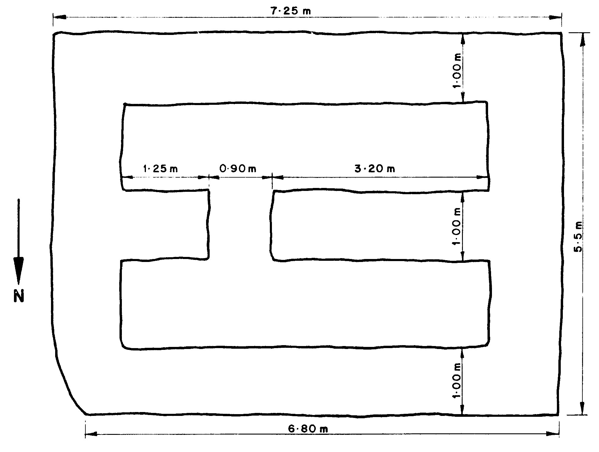
The original excavations took place in the 1960's when access to the site was difficult because of its relative isolation imposed by the surrounding dunes. Now that access has been made easy, there is a danger of wear and tear from an increased number of tourists. The stones are not cemented and a few may very well have disappeared over the past three years. There is a definite need for some sort of control over access before further damage occurs. The plans drawn below at least give an indication of the present state of three cairns. In each case, the scale is 2cm to 1m.
Cairn A (below): central plateau; slight dip to southwest. Walls vary between 1.10m and 1.15m in height.
Cairn B (below): central plateau; beside Cairn A to northwest. Outer wall thickness varies between 0.90m and 1.10m. Height varies between 0.75m and 1.05m.
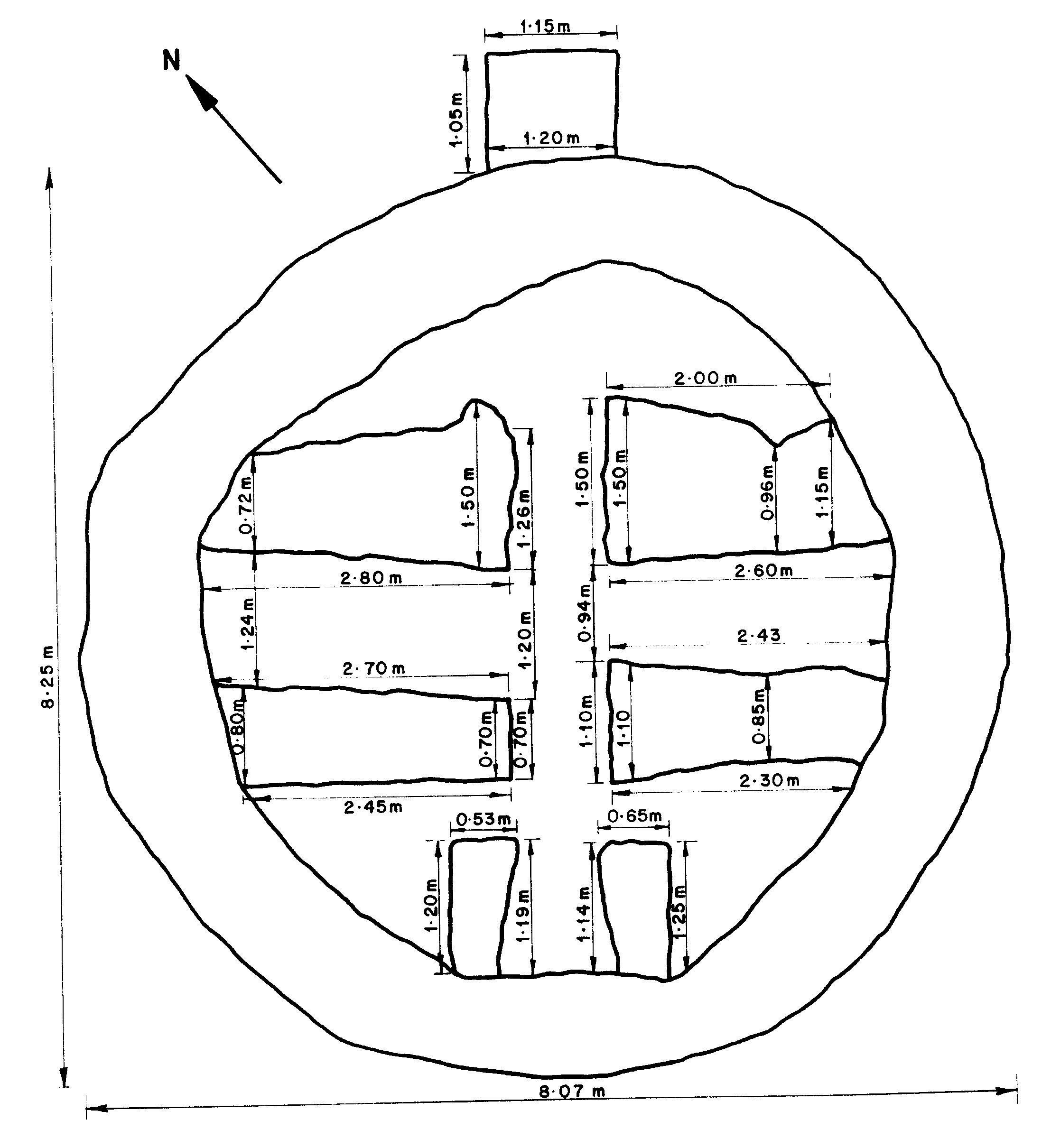
Cairn C (below): north end of plateau. Outer wall varies between 0.65m and 1.10m in thickness. Heights generally a little lower than Cairn B.
