Ibri Fort and City 16 April 2004


Sulaif Fort and City 16 April 2004
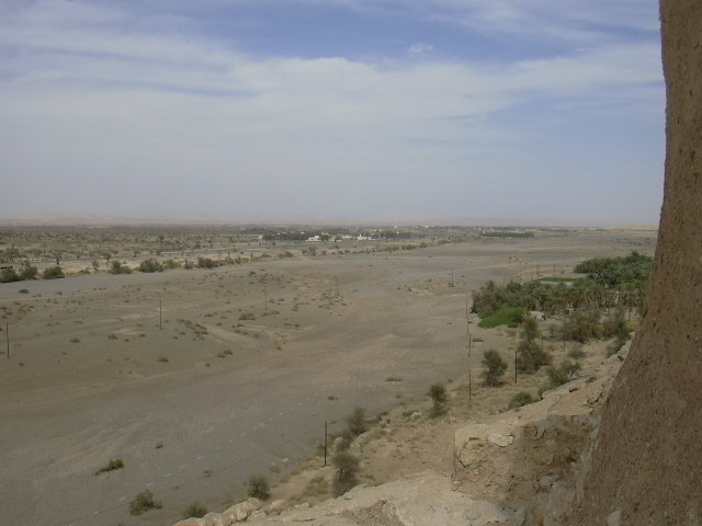
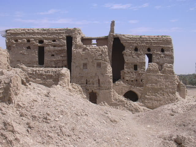
by Brien Holmes

While returning from the Nizwa weekend, I stopped off in Ibri for a quick tour of the old walled city and fort of Sulaif. There are a number of mudbrick buildings in and around modern Ibri, close to the wadi that cuts through the buildings, farms and gardens of the city.

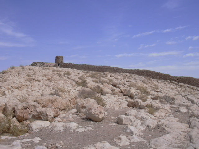
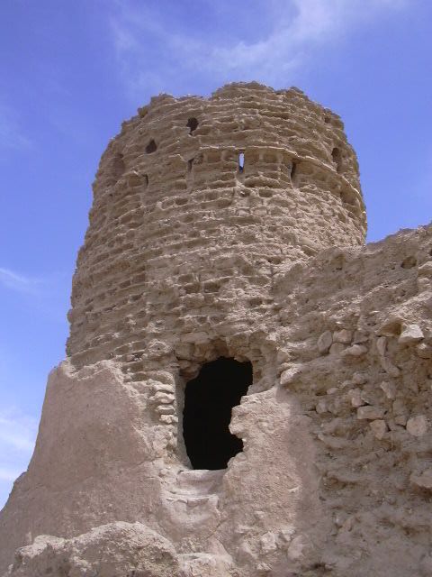
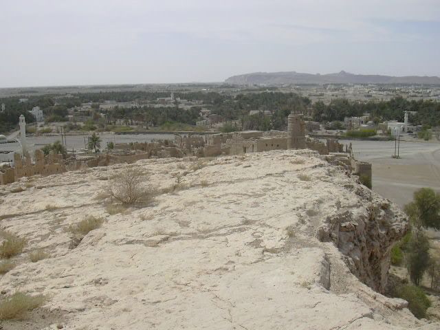
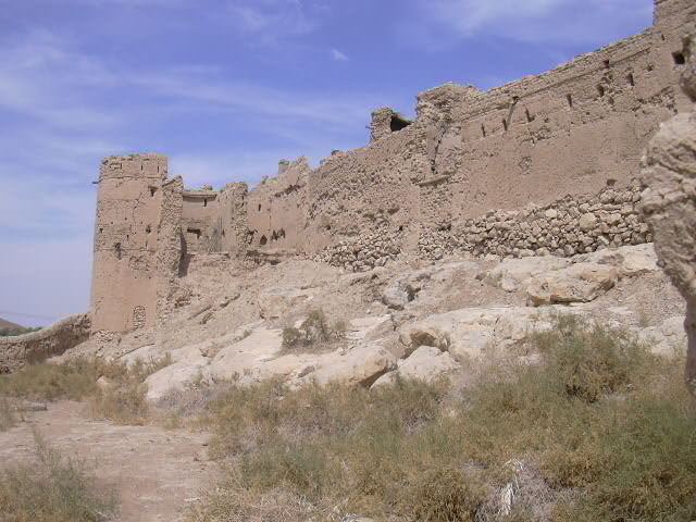
Approaching Ibri from Nizwa, the gap in the mountain ridge is obvious from a considerable distance, and the upper lookout tower of the old walled city/fort clearly visible against the skyline. Observers posted in the tower would have had little difficulty spotting anyone approaching from the direction of Nizwa.

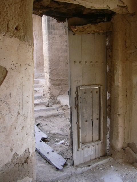
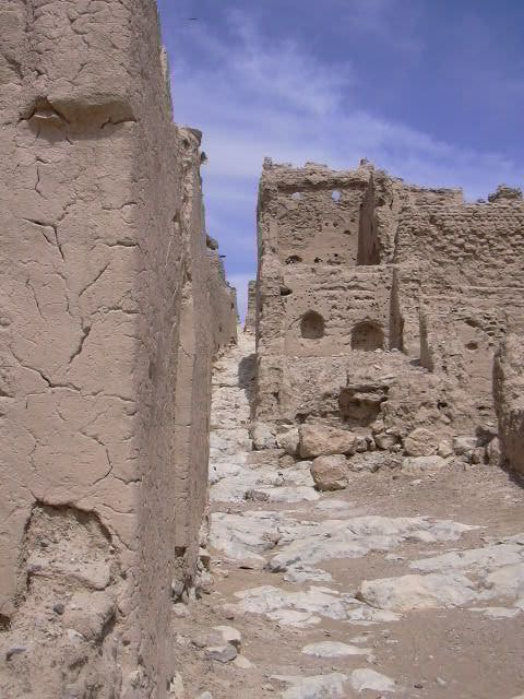
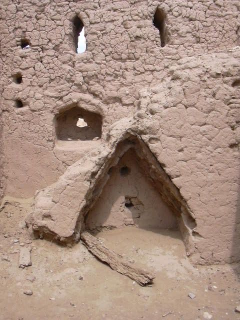
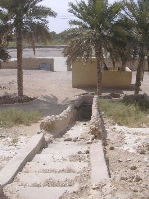
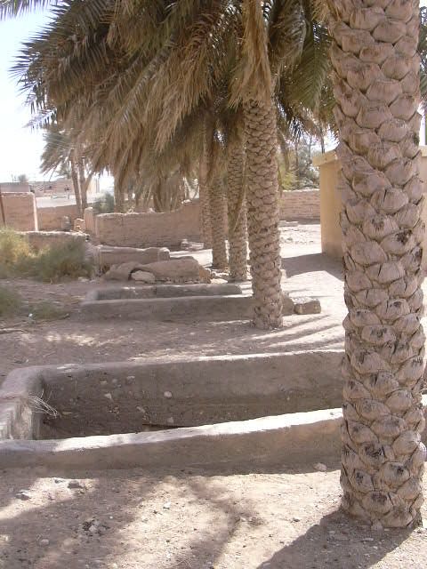
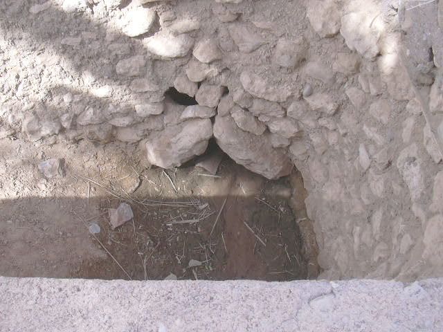
Sulaif is built on a sloping exposure of very uneven rock so the main streets run vertically up and down the slope. The water was eventually directed to a deep channel that is still evident in the entranceway. The entranceway, with one of the original huge wooden doors still in place, was located behind a small room with doors on either side, one door leading to the souq, the other to the underground falaj system. The latter door leads to a set of stairs down to the place where worshippers could bathe before going to mosque, the mosque located immediately inside the entranceway.

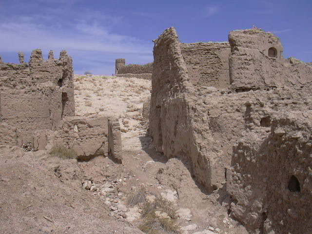
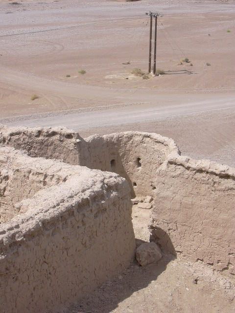
The souq and three access holes are located inside a wall that extends beyond the taller, fortified wall of Sulaif proper.

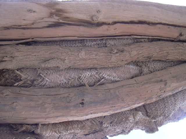
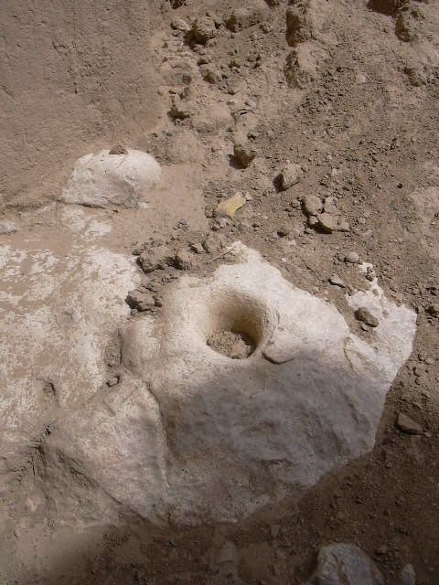
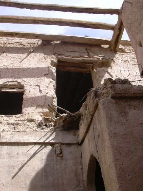
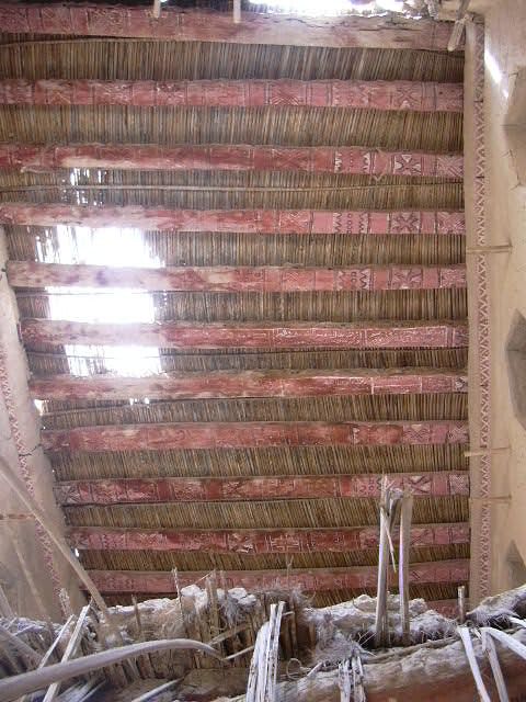
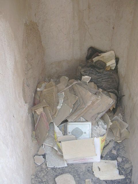
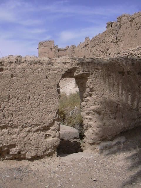
The buildings inside the main wall appear to constructed with a stone foundation on which mudbrick buildings were constructed, most of two storeys. The mudbrick walls were then covered with fine mud plaster. The decoration and construction suggests a relatively wealthy population. Inside the entrance to many of the houses, a mortar was visible in the bedrock, evidence of the custom of preparing and serving fresh coffee to visitors.

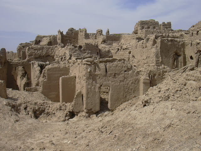
In the souq area, the doors to several of the shops were locked and the condition suggests the shops were in use until a few years ago. The shops looked as though they had been in use more recently than, for example, the covered souq at Hamra.

Elsewhere in Ibri, there are a number of mudbrick buildings including a residential area on the opposite side of the wadi while Sulaif appears to have been located close to the best date gardens. There residential area appears as a walled community, not unlike Manah, Bahla or Nizwa. Elsewhere in the city are a number of watchtowers, most of the rectangular style popular in much of Oman and in some locations in the UAE, including Al Ain.

The mudbrick buildings of Sulaif, together with the beehive tombs of nearby Al Ayn, would make an excellent weekend trip for the group.

ibri01.jpg
Lower watchtower (above) and other defensive structures facing south (towards Nizwa)
ibri02.jpg
Watchtower and part of Sulaif facing the wadi, wall visible lower right
ibri03.jpg
Note how fort/city built on sloping rock, the upper watchtower visible in distance
ibri04.jpg
Looking towards columns that once supported roof for main square of souq
ibri05.jpg
In the area of the main square of the souq
ibri06.jpg
One panel of main gate/door still in place (right) other panel partially burnt on ground
ibri07.jpg
View to the south immediately inside entrance
ibri08.jpg
View to the north immediately inside entrance; note exposed uneven rock
ibri09.jpg
View west and uphill, the street designed as a drain in the event of rain
ibri10.jpg
Most buildings were originally two-storey with high ceilings
ibri11.jpg
View towards upper watchtower, above residential area
ibri12.jpg
Detail view of upper watchtower
ibri13.jpg
View from upper watchtower towards Nizwa (compare this to the view of the wadi in flood at the bottom of this page)
ibri14.jpg
Passageway to one of the small towers built into the east wall
ibri15.jpg
Sharply peaked alcove in a house
ibri16.jpg
Most buildings have been reduced to a mound of 'melted' mudbricks, decaying palm trunks, woven palm matting and other debris
ibri17.jpg
The steep slope of the bedrock is visible in this photo
ibri18.jpg
A solitary pillar is all that remains of the second storey of this house
ibri19.jpg
Several of the houses were very large with eight or ten rooms
ibri21.jpg
Looking over rooftops to the wadi and the modern buildings of Ibri in the distance
ibri22.jpg
One of the smaller towers with vertical slits for vision and shooting
ibri23.jpg
A small extension of the wall overlooking the wadi
ibri24.jpg
A tiny alcove built into the wall below what was once a staircase to the second storey
ibri25.jpg
Archway leading to what was likely a family compound of houses
ibri26.jpg
Another view of the archway
ibri27.jpg
Detail of the ceiling in the archway; note how the palm trunks have been squared
ibri28.jpg
Palm matting remains in place after a door lintel has fallen away; note the impressions left after bricks fell away
ibri29.jpg
Tree limbs used as lintels in this doorway
ibri30.jpg
A mortar worn into the bedrock just inside the doorway of one house
ibri31.jpg
Family rooms had a platform at one end
ibri32.jpg
The ceiling of the family rooms showed evidence of soot and most had a rope suspended from one rafter
ibri33.jpg
Stairs leading to a second storey that has collapsed
ibri34.jpg
Palm trunks are all that remain of the original roof
ibri35.jpg
The roof beams of this second storey room were brightly painted; note decoration on 'plaster' around ceiling
ibri36.jpg
The view from the fort/city entrance of the main square
ibri37.jpg
The mosque, located near the main gate, features a unique mihrab (left) and very narrow minbar (pulpit, right)
ibri38.jpg
On the floor of the mihrab are copies of the Koran
ibri39.jpg
Detail of the unique construction of the mihrab and minbar
ibri40.jpg
View from highest point of Sulaif over the wadi with the city of Ibri beyond
ibri41.jpg
View from the upper watchtower along the east wall
ibri42.jpg
Unusual diamond shaped 'windows' of this small house
ibri43.jpg
View diagonally across main square down towards entrance (arch and tower visible)
ibri44.jpg
Pillars, finely plastered, inside the mosque
ibri45.jpg
View of interior of the mosque
ibri46.jpg
View from entrance vestibule down to falaj
ibri47.jpg
Doorway through an interior wall to accessway to underground falaj
ibri51.jpg
View through doorway to main defensive wall of Sulaif
ibri48.jpg
View of three accessways to the underground falaj
ibri49.jpg
The corbel (sloping rocks) of the ceiling of the heavily silted falaj
ibri50.jpg
Steps (left) leading to silted falaj where worshippers would have done their ablutions before prayer

Nick Dekker, who worked on water resources projects in Oman years ago, noticed this page and contributed the amazing photo below of the Sulaif wadi in flood.

Nick wrote: "In reading your excellent field trip Reports I noticed that you had one under the title Ibri, and the old walled village. Actually the old mud walled village is called Sulaif. Old Ibri is some distance away.

"In Ronald Codrai's book 'Oman: An Arabian Album', there are some excellent old historic photos of farming at Sulaif, one of them showing the village in the background.

"For your interest I attach a photo of the wadi flooding past Sulaif, taken from the hill where we were building a large water reservoir for the Ibri regional water scheme. I saw this wadi flooding twice and the water runs for about a further 20 to 30 kms into the desert."

For more on Nick, click here.


Back Home Up Next

ENHG chapters Bulletins Tribulus eBooks Al Ain Field Trips Al Ain Resources Contacts

Copyright © 1977-2011 Emirates Natural History Group
Patron: H.E. Sheikh Nahayan bin Mubarak Al Nahayan

Served from Molalla, Oregon, United States of America