Cliff Walk on Jebel Shams 15 April 2004
Cliff Walk on Jebel Shams 15 April 2004
 by Brien Holmes
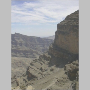
There have been a few changes since the ENHG last organized a walk along cliff face of Jebel Shams to an abandoned village located overlooking the gaping gorge of Wadi Ghoul, not far from Hamra, in Oman.
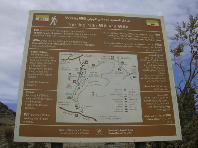
The Oman government, which last year allowed the construction of small chalets near the summit, had identified three hiking trails on Jebel Shams: one to the abandoned village; one to the opposite side of Jebel Shams (where the radar station is located); and one down the mountain to Ghoul village. The most significant improvement has been the upgrading of the road; most of the lower section has been widened and paved though the grade is still steep and the corners very sharp. Workmen continue to install electricity to the remove villages dotted over the mountain.
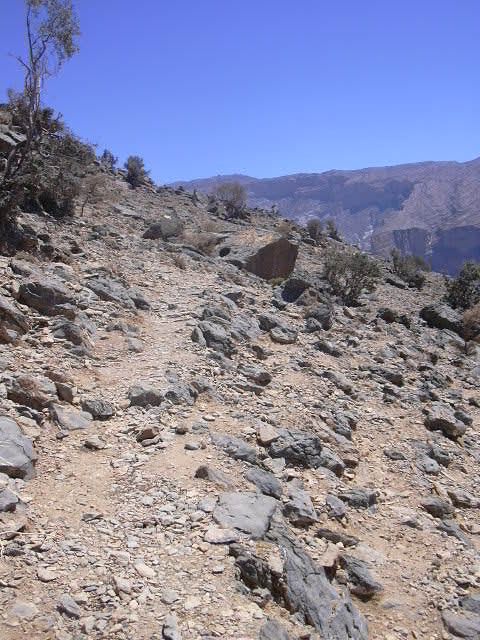
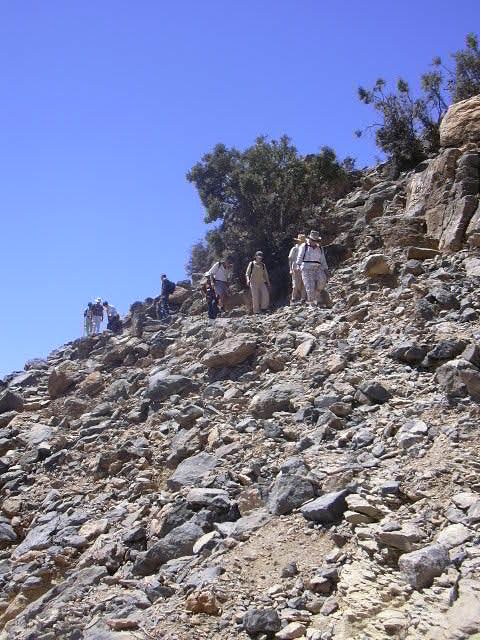
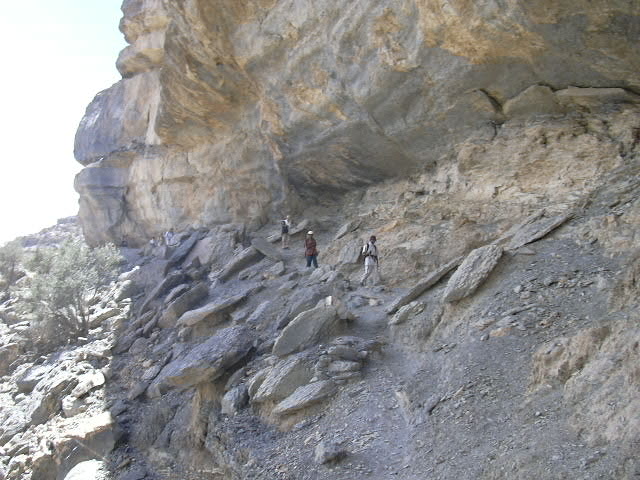
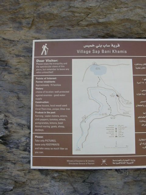
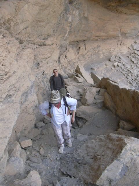
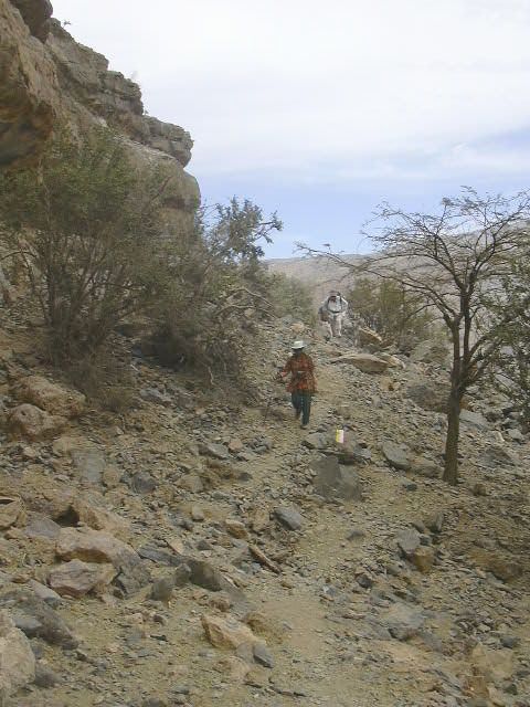
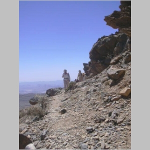
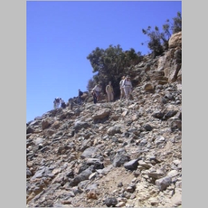
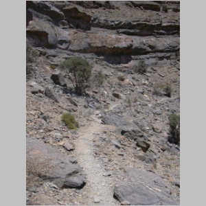
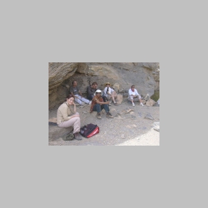
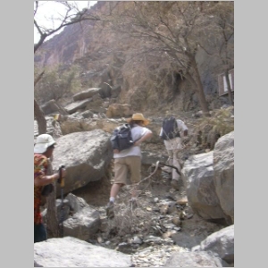
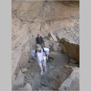
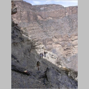
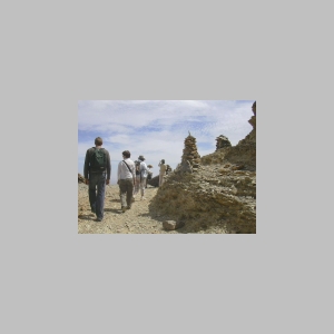
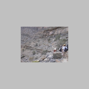
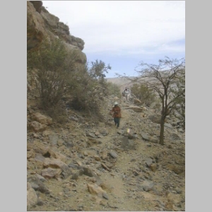
Ten Al Ain members enjoyed a leisurely walk along the cliff face; it was the first time on the hike for nine of the trekkers. From the new signboards, we know the trail is approximately four kilometers in total and the hike in should take about an hour. We also learned that the village is known as Sap Bani Khamis and had, at one time, approximately 15 families.
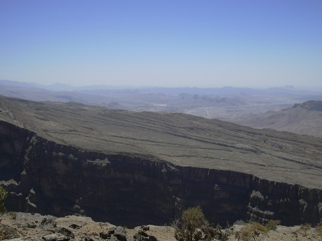
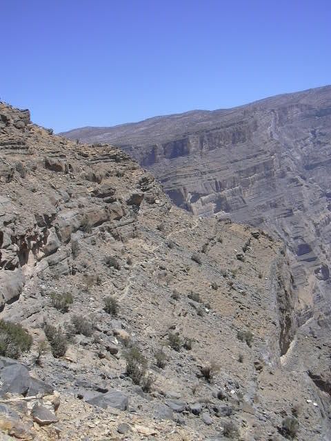
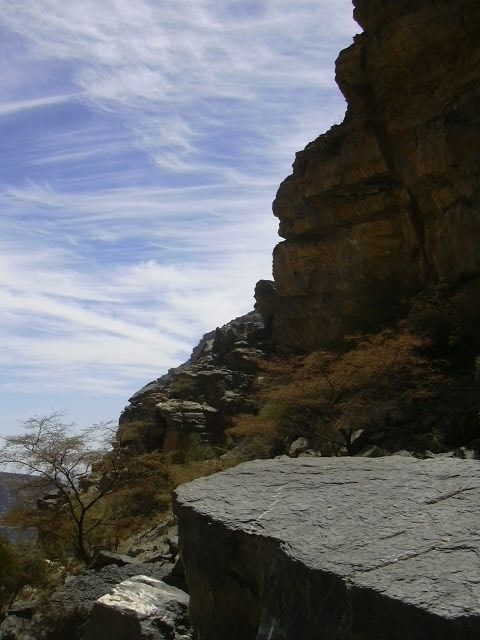
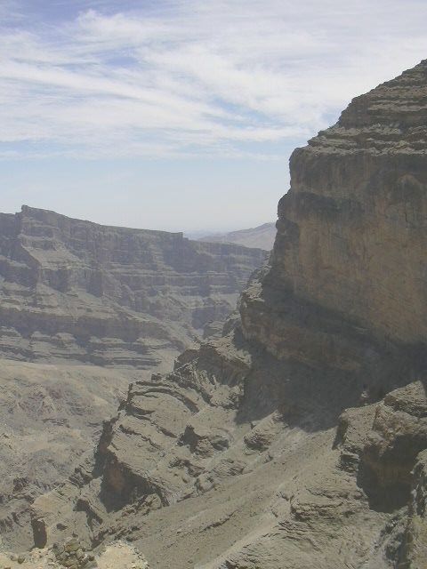
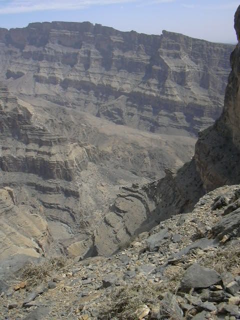
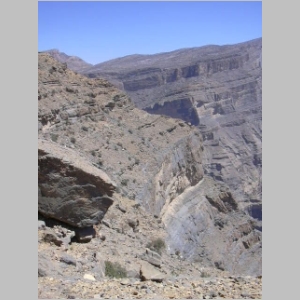
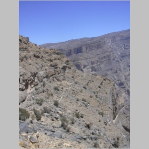
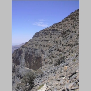
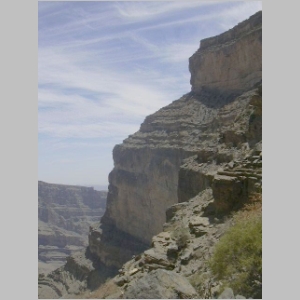
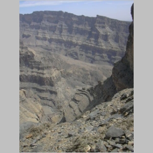
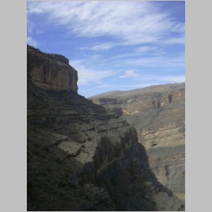
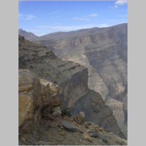
The Lonely Planet guide to Oman and the signboards indicate the height of Jebel Shams in the vicinity of the cliff walk is about 2000 meters and the drop from the trail to the wadibed below more than 1000 meters. (A GPS reading midway along the trail indicated an elevation of more than 1800 meters.)
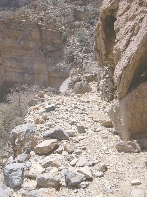
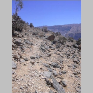
Another improvement, some would agree, is the painting of yellow, white and orange bars in a stylized flag at various points along the trail. This is an improvement to some extent as the trail is occasionally difficult to spot after rockslides; the trail is also difficult to follow in some of the steeply graded sections.
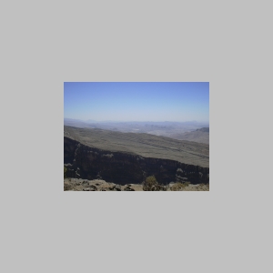
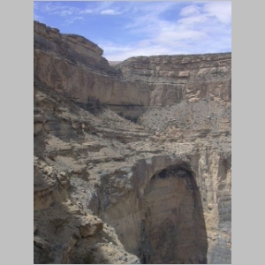
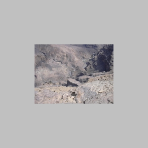
As a result of the chalets, the signboards and the trail markers, the well-defined trail suggests more individuals are enjoying this breath-taking walk. The scenery, from the initial look down at Wadi Ghoul and Hamra, several kilometers away, to the vertical rock exposures all around make it an unforgettable event.
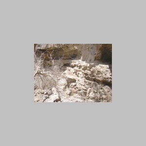
At the village, a few of the artifacts have disappeared since our last visit, notably large gourdes that were used as storage containers. It was good to see the grinding wheel, located on an elevated platform between two of the houses, has been secured with wire rope.
A signboard at the houses reminds visitors to 'take only photographs and leave only footprints'; most seem to be following the request as there was very little evidence of litter.
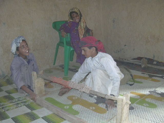
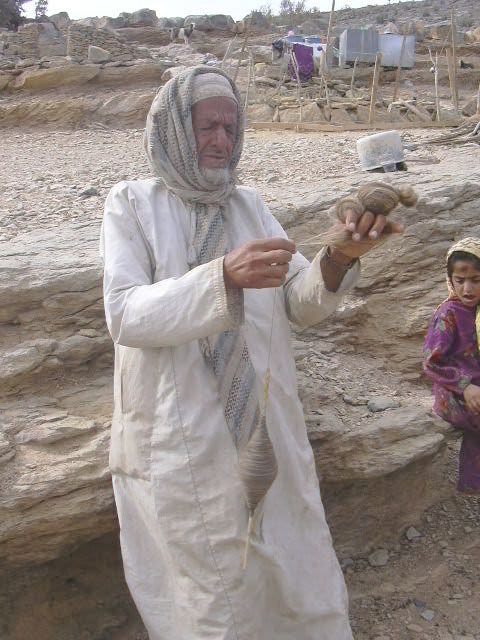
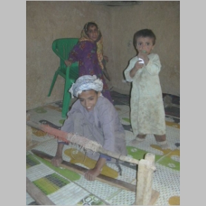
Back at the head of the trail, in the small farm, the weavers did not have any carpets in the loom but the children gladly demonstrated how the loom operated. The elder of the family also demonstrated the spindle used to spin the goat hair into yarn.
By the time our group was ready to head down the mountain, several of the carpet sellers were stationed at the shelters along the road.
At the bottom of this page, you will see two additional photographs taken by
Nick Dekker who worked on water projects in Oman and the UAE.
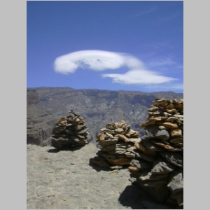
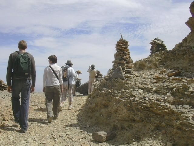
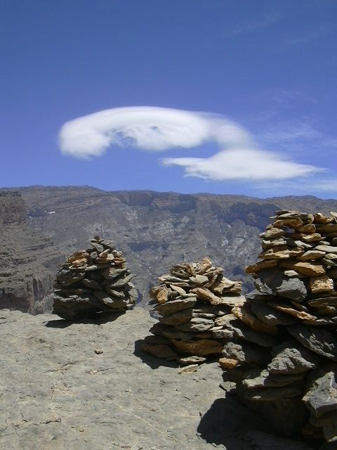
Trail cairns at the first stop, a third of the way to the village |
View from the road looking down at the second stop |

View from the road looking down at the terraces of the village |
At the head of the trail, looking down at Wadi Ghoul |
At the head of the trail, looking down at Hamra |
Increased traffic has resulted in a well-defined trail |
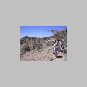
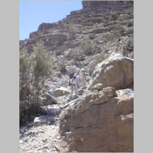
The ENHG hikers begin the trek to the village |
View from the 'big rock' down to the first stop |
A constant breeze and temperature of 26' made ideal conditions |
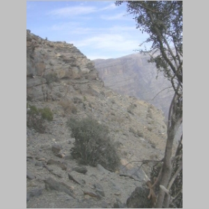
Trail visible on the sloping face of Jebel Shams |
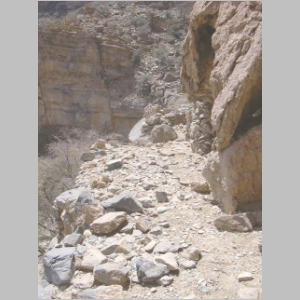
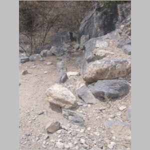
Recent rock slides made some sections challenging |
View looking back to 'big rock', the trail blending in with the cliff face |
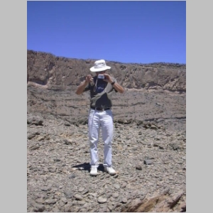
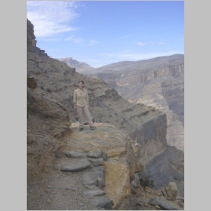
The photographer (Tom) being photographed |
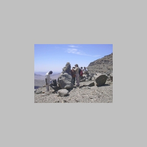
Hikers added their own stones to the cairns at the first stop |
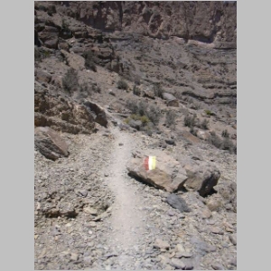
Trail markers made the route more than obvious |
Most of the elevation lost on the hike is during the first section |
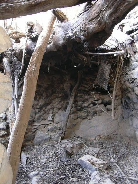
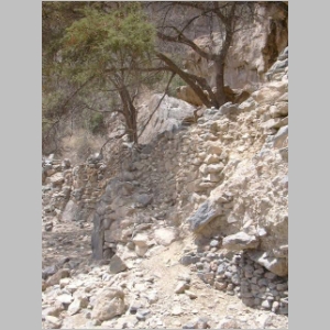
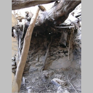
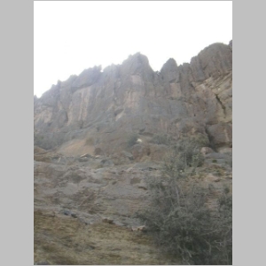
The first structures appear about midway along the trail |
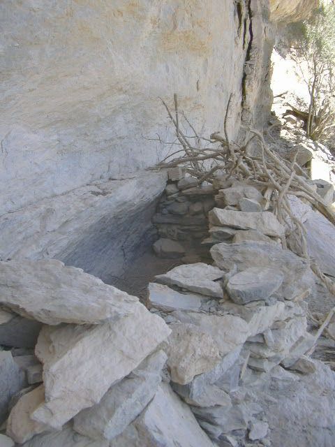
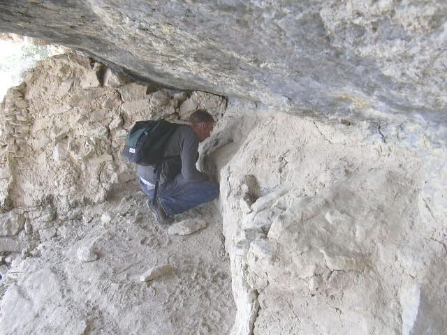
The walled structures are tucked under overhanging rock |
The structures do not appear to be houses; they may be intended for livestock |
The structures would be suitable for newborn goats (kids) and their mothers (nannies) |
Hikers take a few moments to inspect the structures and enjoy the view |

The view back to the first stop (center of image) |
The trail is approximately 4 km in length (out and back) |
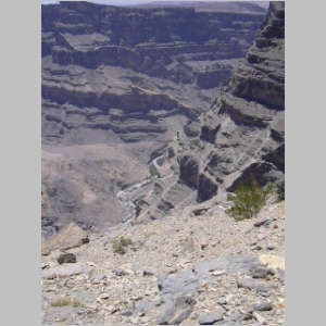
View down to the wadi bed below, more than 1000 meters down |
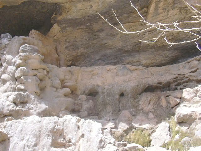
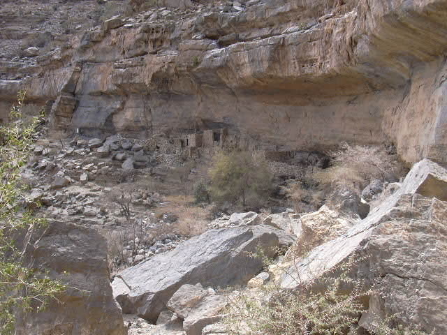
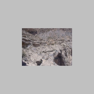
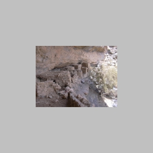
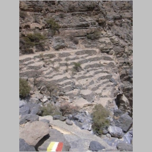
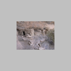
At the second stop, first view of the terraces and houses |
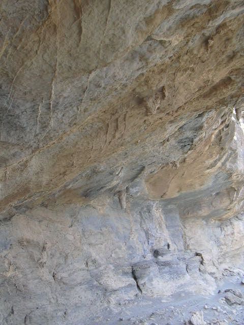
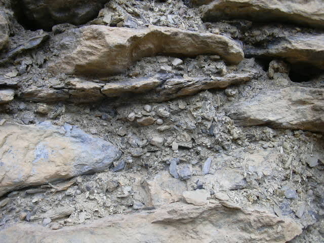
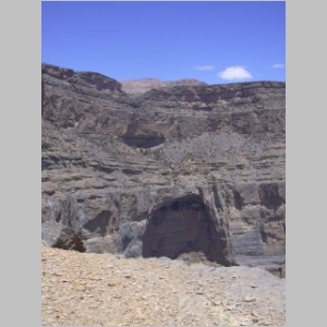
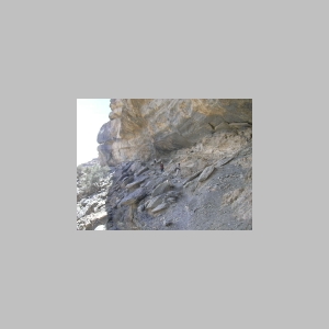
Terraces visible above the huge cavity in the cliff face |
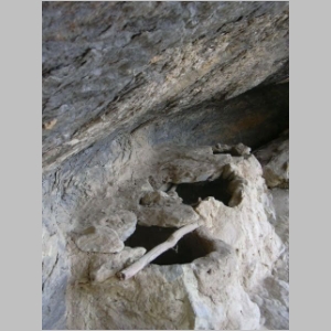
Stalactites drop down from the overhanging rock |
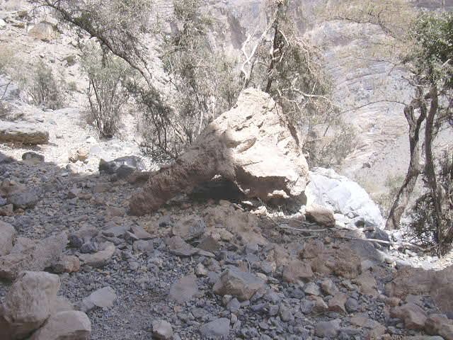
One of the fallen stalactites |
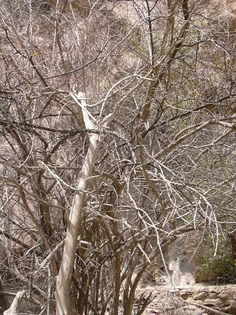
One of the famous Jebel Shams tree-climbing goats |
Terraces appear larger as we get closer to the village |
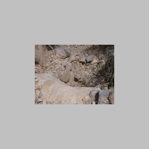
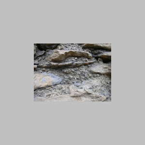
Hikers pass a section of shale along the trail |
Terraces above the shadow of the huge undercut |
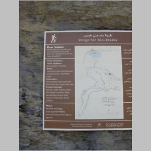
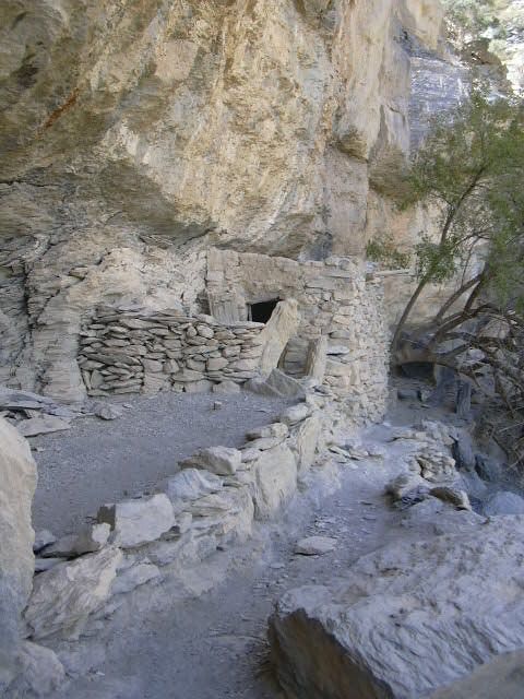
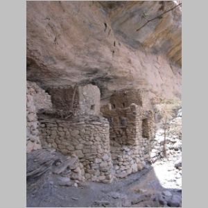
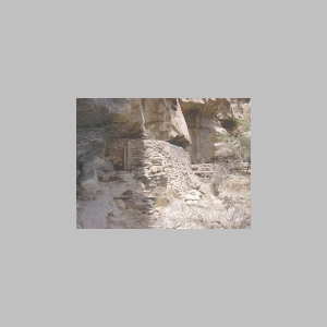
A new signboard identified the site as Village Sap Bani Khamis |
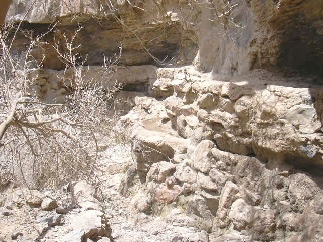
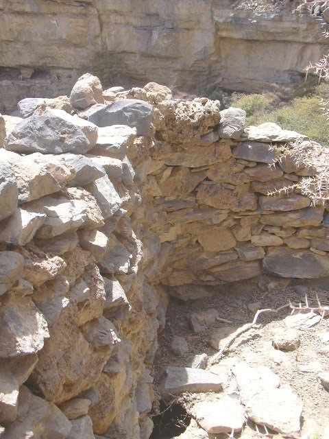
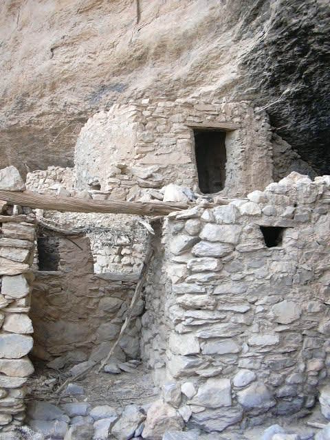
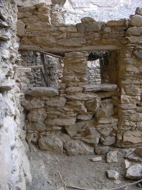
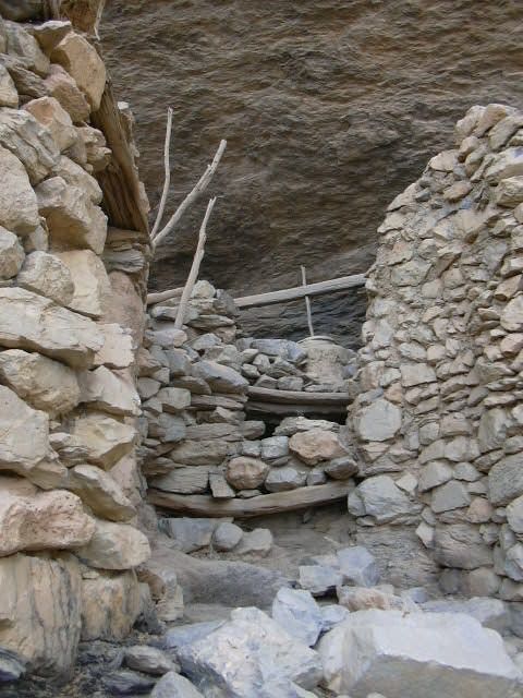
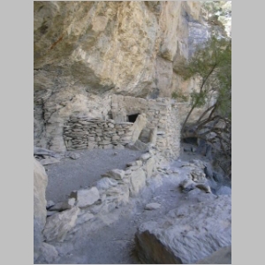
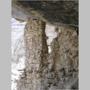
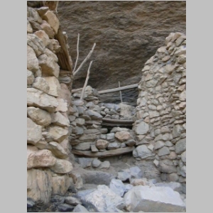
The neatly built stone houses where an estimated 15 families once lived |
The Oman government has provided some details of life in the village |
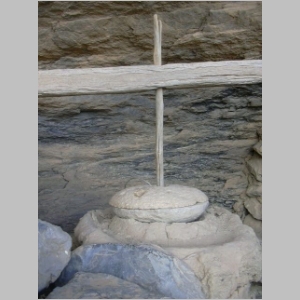
The grinding wheel cannot be stolen now |
Villagers grew a variety of crops and harvested pomegranates |
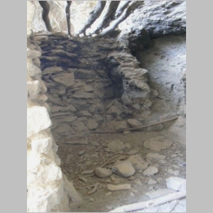
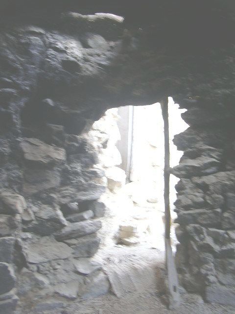
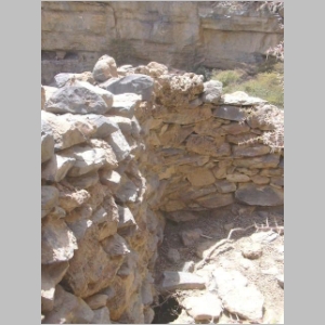
Houses were built up against the wall of the mountain |
The black stones used as steps are polished as a result of the many visitors |
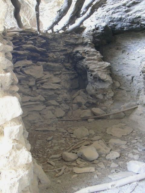
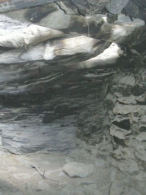
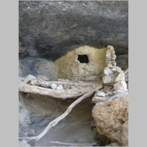
Most houses were dark with low ceilings and extremely cramped quarters |
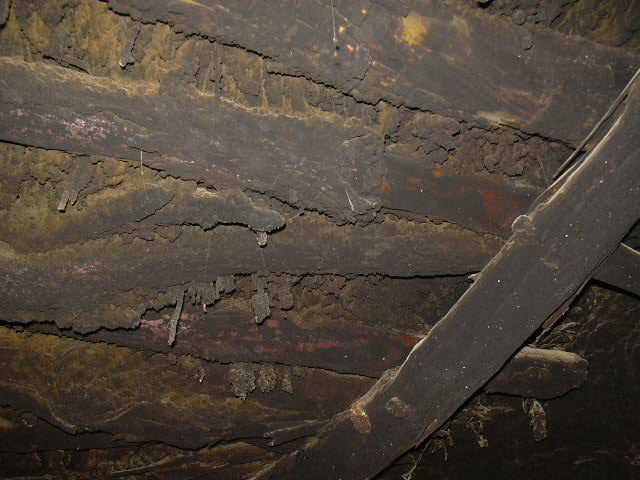
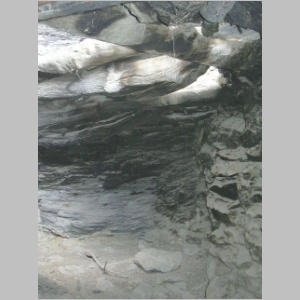
Ceilings of the houses are stained with years of soot from cooking fires |
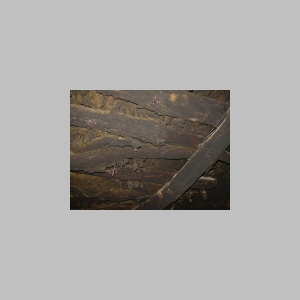
Twigs, branches and tree limbs were used in house construction |
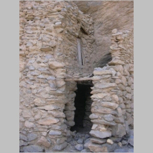
Several of the houses consist of two storeys |
View from the houses back to the second stop |
View from the houses to the nearby terraces |
A solitary houses is located in the same area as the terraces |
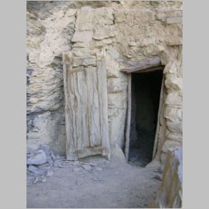
The door of the solitary house has not been taken, but gourdes used for storage have disappeared |
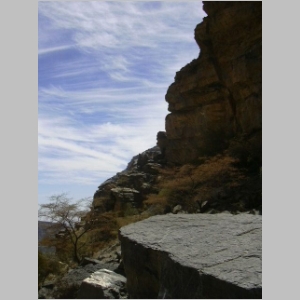
Profile of a person against the photogenic clouds |
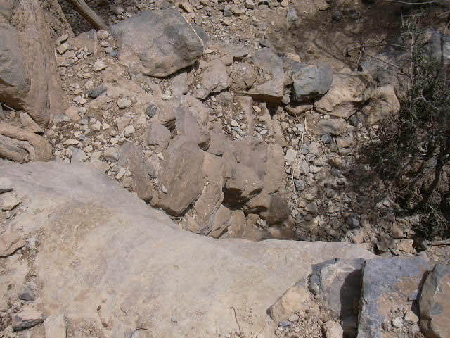
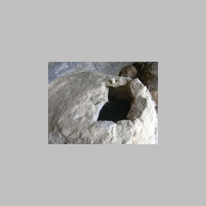
The cistern above the terraces is dry, springs above having dried up |
The cistern was filled from a small pool located at the base of the escarpment above |

Two fallaj channels, upper and lower, were fed from the cistern |
The two falaj channels winding towards the terraces |
A few bright red pomegranate blossoms are visible on this failing tree |
Looking back from the terraces, one wonders where the trail is |
The untended fallaj (bottom, center) |
Storage bins of mud were used to keep pomegranate and other produce |
Chris found pomegranates in one of the storage bins |
Detail of one of the storage bins |
A stone column in the granary area |
A solitary storage bin, a granary room located below |
Above the granary and storage bins are manmade walkways and cave dwellings |
The wall at the end of one of the walkways |
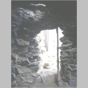
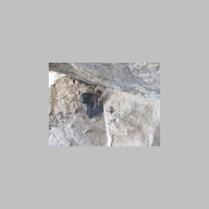
The interior of one of the small cave dwellings |
View straight down at the steps leading up to the cave dwellings |
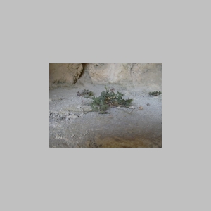
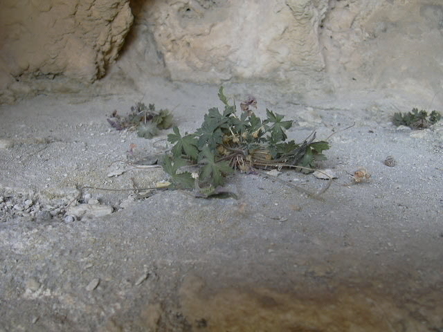
A few plants survive on the floor of one of the cave dwellings |
There is almost no pottery on the site and only a few freshwater snail shells |
A forked tree limb was used to keep the pomegranate limbs elevated, away from hungry goats |
A dried pomegranate (center of image) from the last crop |
Detail of the carefully crafted outlet from the cistern |
Note the channel used to divert water from the cistern outlet to a small mud basin (lower left) |
Despite having fallen over, this ghaf tree seems to find sufficient water to survive |
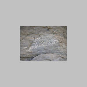
Arabic script on the cliff face near the houses of the village |
Some of the trekkers preparing for the return leg of the hike |
View from the terraces back to the houses |
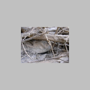
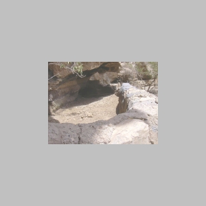
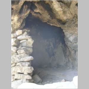
What appears to be a shelter built under a huge boulder |
Another view of the shelter built under a boulder |

Visitors are reminded to 'take only photographs, leave only footprints' |
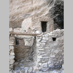
The overhang provides some protection for the houses |
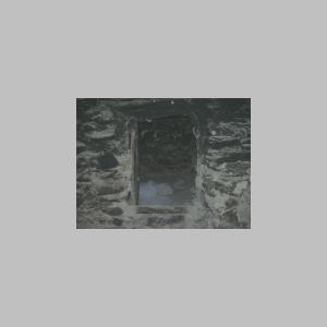
The sooty interior of one house, the sooty air once reaching down to the floor level |
A huge tree limb was used for the roof of this house |
The "mortar" used includes small stones, shells and seeds from the ghaf tree |
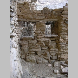
Well-built wall of this house boasts windows that are still rectangular |
Note the ledge at the end of the room in this house |
Individuals using the grinding wheel had to climb several steps |
The village was apparently abandoned when the water supply stopped flowing |
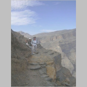
The 10 hikers in our group begin the trek back to the vehicles |
This was the first hike to the village for nine of the ten hikers |
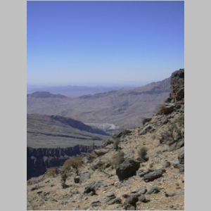
The view across the gorge to the other side of Jebel Shams |

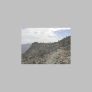
Much of the trail, like this section, is clear and flat |
A few sections of the trail, however, are moderately steep with loose rocks |
A final look back at the village |
The stone cairns at the second stop |

Deborah looks ahead to see if she can spot the trail |
The rooftops of modern houses are visible in the wadibed below (center of image) |
The trail visible along the cliff face |
The group completed the return leg in about an hour and a half |
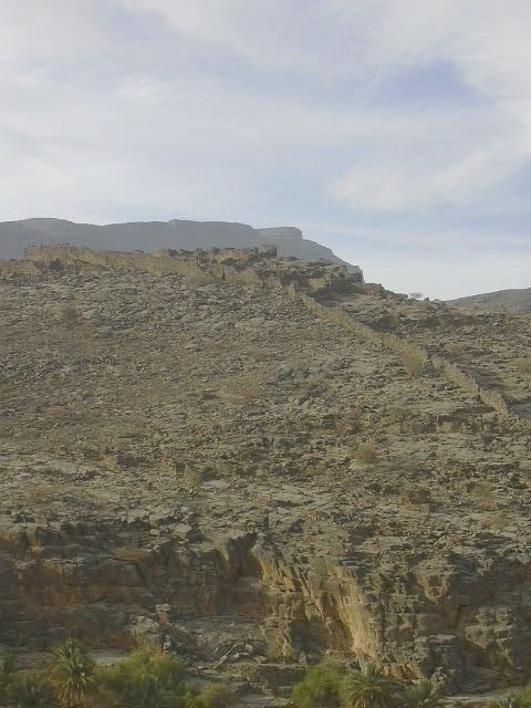
The summit of Jebel Shams in the distance |
Most of the trail is located on a wide ledge covered with sloping stone debris |
Goats feeding on the little vegetation left on the mountain |
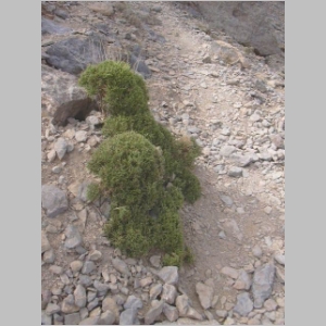
Bushes neatly pruned by the goats |
Looking back to the first stop, the thin white line of the trail visible |
Deborah on a prominent rock as we end the hike |
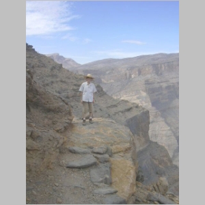
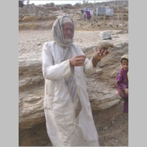
Angela's keepsake reminder of the Jebel Shams' hike |
Anne managed to keep her hat for the duration |
The final few meters back to the farm at the head of the trail |
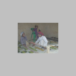
Boys demonstrating how to operate the loom |
Jebel Shams' carpets are popular keepsakes for hikers |
The eldest family member demonstrates spinning goat hair into yarn |
He uses a 'vertical spinning wheel' to make the yarn |
Some carpets now include manmade yarn, though carpets of wool and goat hair are still being made |
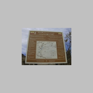
A signboard at the farm showing three of the hiking trails on Jebel Shams |
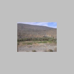
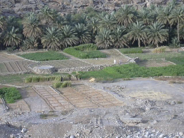
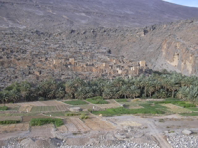
The old walled village of Ghoul in the rich afternoon sunlight |
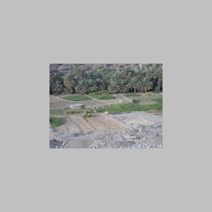
Women (center of image) carrying fresh-cut grass from the fields |
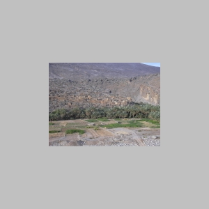
Reduced water supplies mean some of the farm plots are unused this season |

A final glimpse of the starting point for the hike (prominent peak, center of image) |
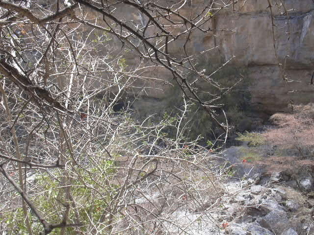
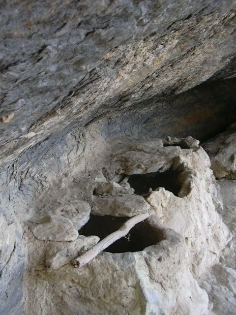
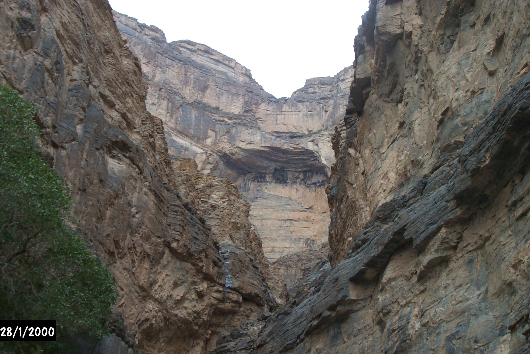
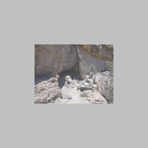
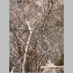
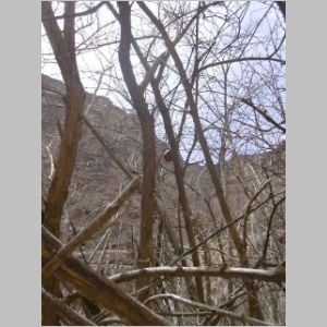
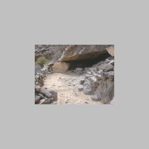
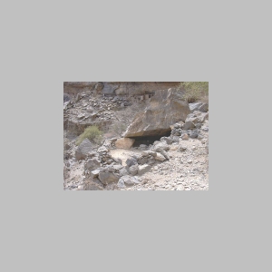
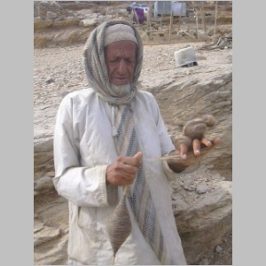
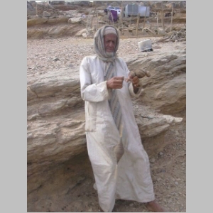
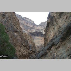
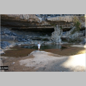
Nick Dekker's photos from Jebel Shams and Nakr.
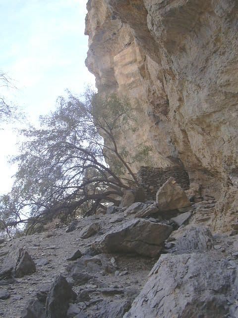
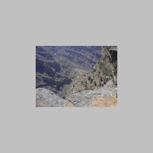
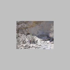
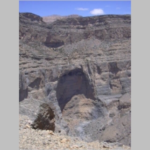
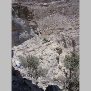
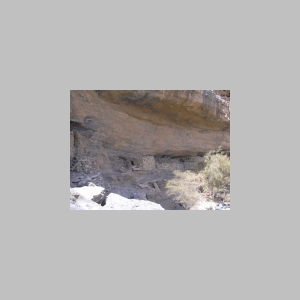
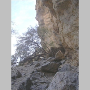
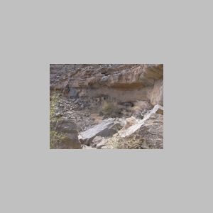
The photograph on the left was taken from the floor of the canyon, near the
village of Nakr, looking up at the village. The village is located above
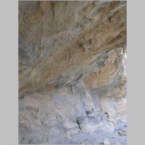
the overhang which is visible in the middle of the photo. The photograph on the
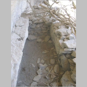
right is taken at the reservoir located above the village at the end of the
'cliff walk' traill.
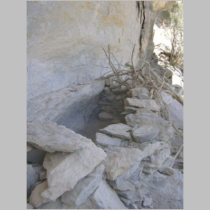
Nick writes:
"When I was exploring inside the Grand Canyon I took this one of the cliff village area
from a spot beyond the village of Nakr. The Nakr villagers are very friendly.
"The first time I went there, 1999 I think, there were four of us (two males and two females)
and the villagers invited us all up the stone staircase into their house for gah'hawah.
"The second time I went I was with a male friend and I took a copy of a couple of the
earlier photos and the villagers were delighted.
"The third time I was on my own and only got as far as the cliff in the previous photo.
I sure would like to know what it is like at the end."
For more about Nick, click here.
|