By Laurence Garey and Brien Holmes
In the mid-20th century, when oil and gas exploration activities were widespread following
the second World War, airplanes were used in support of the on-ground activities. As a result,
airfields were constructed in many remote locations. The Al Ain chapter of the ENHG, with the
encouragement of Laurence Garey, who has chronicled the aviation history of the region, has
located and documented several of these remote airstrips. Since those who constructed the landing
strip discussed here, the spelling they chose for the location is used throughout.
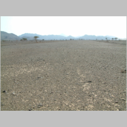
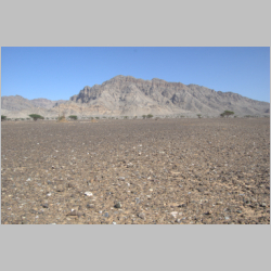
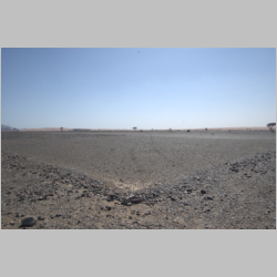
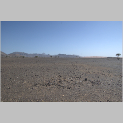
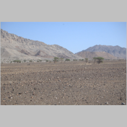
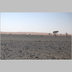
One of these airstrips is a small landing strip in Wadi Sumaini, located close to Jebel
Sumaini in the wide gravel plain that empties into the Madam Plain.
Colin Richardson, who wrote the book "Masirah, Tales from a Desert Island", was a Venom
fighter pilot with the RAF in Sharjah during the Jebel Akhdar conflict in the late 1950s,
and then joined the Oman Air Force in 1973.
He remembers landing at Sumaini in 1975 in a Beaver (a superb Canadian plane, although we
tend to think of it landing on a lake in Ontario rather than the Omani desert). He was taking
"something or someone" to a Scottish army officer at the nearby Oman Gendarmerie fort, that
controlled the border. It still exists just north of the field. He says Sumaini was very
neat and tidy even then.
In recent years (2000 to 2009), quarrying activity has accelerated in Wadi Sumaini to satisfy
the need for aggregate for road building and other construction projects. Though new roads have
been built and two quarry operations expanded near the abandoned airstrip, the airstrip remains
intact.
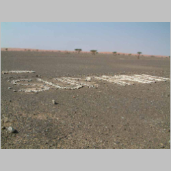
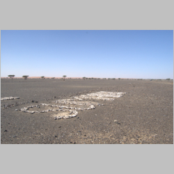
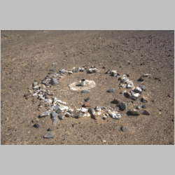
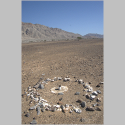
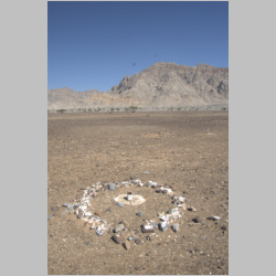
The landing strip is narrow at 45 meters and about 460 meters in length. A small apron is located
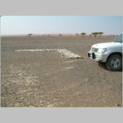
on the east side. A flag pole was constructed just beyond the apron and the name "Sumaini" is spelled
out in white-washed stones.
The four corners are marked with rectangles arranged in right angles to frame the strip. Along the side
are 16 rectangles -- eight along the eastern and western sides -- about one meter in length and a half a
meter wide, marking the perimeter of the strip.
The bearing is approximately 133' (or 315'). The numbers are painted on big runways but not at Sumaini.
The International Civil Aviation Organization (ICAO) does not list an "indicator" for Sumaini.
Other local ones are Al Ain OMAL, Sharjah OMSJ, Dubai OMDB and Saiq OOSQ. Saiq is a similarly small landing strip.
The UAE uses OM and Oman OO.
The white-washed stones that marked the corners and sides of the strip would have been visible
clearly from the air as they contrasted sharply with the dark stones of Wadi Sumaini.
The strip is clearly visible on Google Earth.
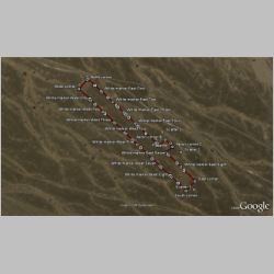
Google Earth image with GPS data added |
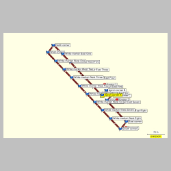
GPS data from MapSource program |
Laurence Garey, who has contributed and collected a great deal of information about the aviation history
of the region, organized a visit to find the Sumaini landing strip in November, 2006.
|
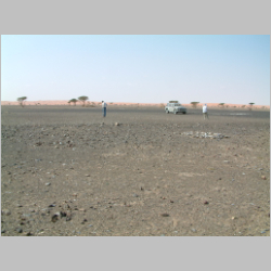
 Jerry (right) and Brien at northern end of the strip
|
 The nose of Bob's truck near the chevron in the northwest
corner
The nose of Bob's truck near the chevron in the northwest
corner
|
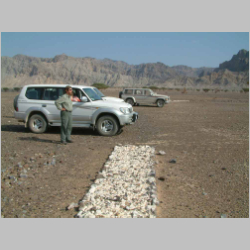
 View along length of the strip from northern end
|
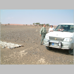 Bob and Josette -- and Barb inside -- at the northern end of the
strip
Bob and Josette -- and Barb inside -- at the northern end of the
strip
|
|
 Bob surveying the site from northern end of the strip
|
 Diagonal view of the name
|
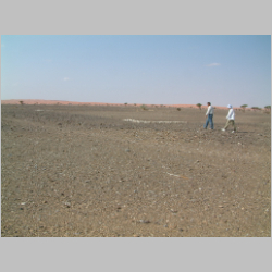 Brien and Josette walking the site
|
 Brien and Josette in the area of the apron, the flag pole base
(middle, right)
Brien and Josette in the area of the apron, the flag pole base
(middle, right)
|
Construction appears to have been done by hand. Along the east and west sides of the strip, and around
the perimeter of the apron, small piles of stones remain, each pile about the quantity of stone that might
be removed by a wheel barrow. Given the total area of 22,500 square meters (for the landing strip only)
this must have taken many individuals some time to complete.
The spelling of the name -- Sumaini -- in English only suggests the strip was constructed by oil
and gas exploration companies or some other organization for which the principle language of
communication was English. One might expect most of the pilots hired for the region were former
military pilots.
The use of white-wash to paint the stones was common practice and would have been effective to
assist pilots to locate the strip and navigate the landing. The corner chevrons and rectangles along
the east and west sides were constructed with larger stones forming the edges and the area filled with
slightly smaller stones. The constructions are only one course of stones.
The lack of any material relating to aircraft suggests the strip was not used for a long period of
time or the individuals operating the strip were incredibly efficient and tidy. There is no evidence of
spilled fuel or oil and none of the trash -- used oil filters, metal containers, tires -- that one
associates with landing strip operations. The brief life span of the strip is re-enforced by the lack
of any shelter or foundation. The only construction, other than the landing strip markers and name, is the
flagpole which consists of a large-diameter pipe inserted vertically in the gravel plain just a meter from
the eastern edge of the apron.
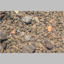
The only other material observed from the site is pottery. Three pottery scatters were recorded in
the immediate vicinity of the strip. Since the wadi has likely been used for hundreds, if not thousands
of years by caravans, the appearance of broken cooking pots is not unexpected. The wadi is part of a
route that extends from the oasis communities along the foothills of the Hajar Mountains -- in the Mahadah
area -- through the mountains at Ray to Wadi Sumaini. An Oman border post is located on the main route
these caravans would have followed. The existing border post is located about five kilometers north of
the Sumaini landing strip.
|
 The chevron in the northeast corner of the strip
|
 View looking down the runway from northern end
|
 The Chevron in the northwest corner of the strip
|
 One of the rectangles marking the perimeter along the west side
|
|
 Edge of runway marker on west side
|
 View diagonally across strip towards apron
|
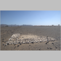
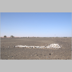
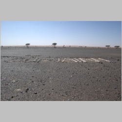 "Sumaini" spelled out in white-washed stones
|
 Landing strip name looking north
|
|
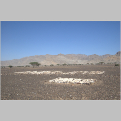 View from landing strip with east marker and name in
foreground, Oman border checkpoint in the distance
View from landing strip with east marker and name in
foreground, Oman border checkpoint in the distance
|
 Back corner of apron; none of the apron stones is
white-washed so pilots would not confuse apron and landing strip
Back corner of apron; none of the apron stones is
white-washed so pilots would not confuse apron and landing strip
|
 Flagpole base detail
|
 Flagpole base looking southeast
|
|
 Flagpole
|
 Flagpole
|
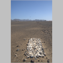
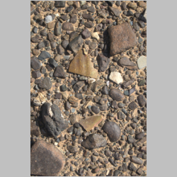
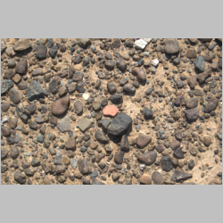 Pot shard of red cooking pot from southern end of landing
strip
Pot shard of red cooking pot from southern end of landing
strip
|
 Pot shard in situ
|
|
 The chevron in the southeast corner of the strip
|
 The chevron in the southwest corner
|
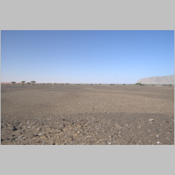 View from southern end of strip
|
 View looking south; no evidence of other markers to help
pilots locate the strip
View looking south; no evidence of other markers to help
pilots locate the strip
|
|
 Pot shard of red cooking pot in situ
|
 A pair of donkeys observing
|
 Pot shard of red cooking pot in situ
|
 Pair of pot shards in situ
|
|
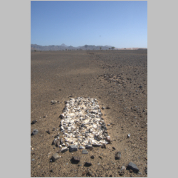
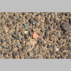
 Pot shard of red cooking pot in situ. Two red pot cooking
scatters were recorded.
Pot shard of red cooking pot in situ. Two red pot cooking
scatters were recorded.
|
 Pot shards in situ.
|
 Cautious donkeys grazing west of the strip
|
 Double glazed pot in situ
|